XINJIANG

From Kanas to the Pamirs —
our longest drive

800 to 4,700 metres, roughly 5,000 km in total. What this route tests is pacing: we keep daily driving under 400 km, run two drivers and carry a satellite phone.

8–14
days
2–8
private group
Jun–Oct
best window
12,600
RMB from / person
HIGHLIGHTS

Six places this route covers

In Xinjiang the difficulty isn't the sights, it's the distance between them. We order by driving line, not by fame.
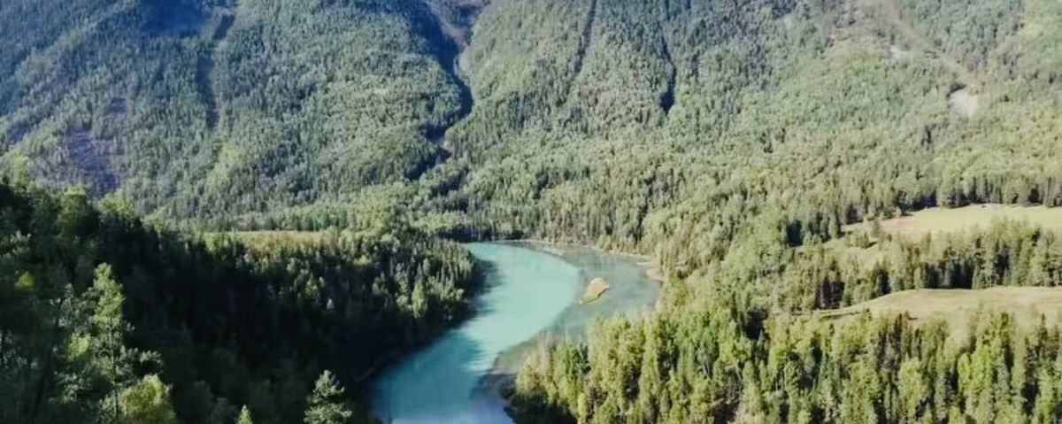
Kanas Lake
Altay · 1,374m

Kanas Lake

September birch forest — the shortest and best two weeks of the year.
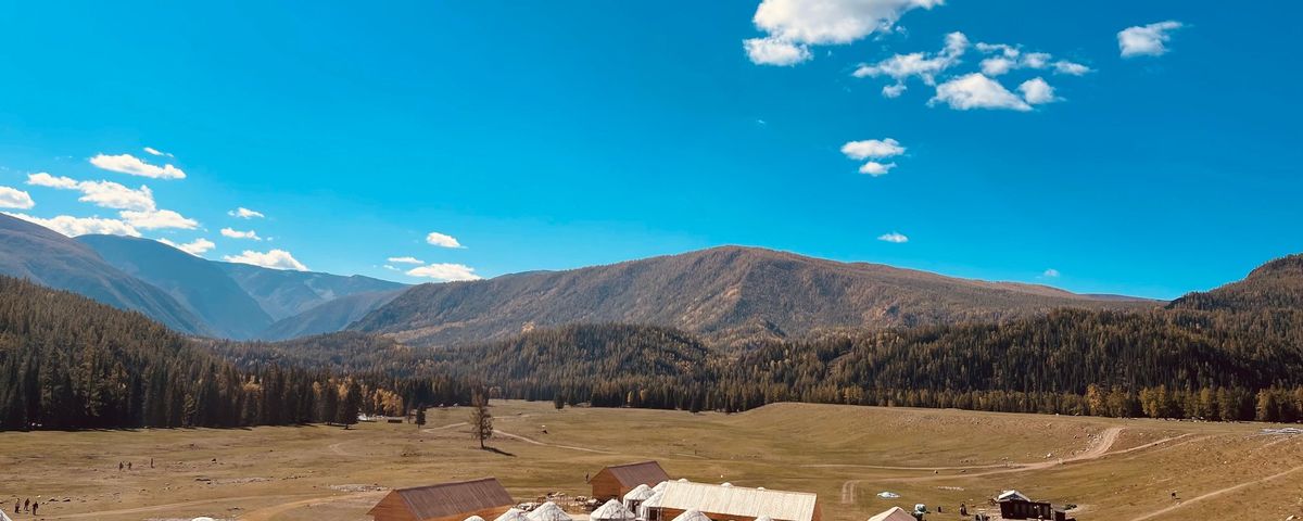
Hemu village wooden cabins
Burqin · 1,400m

Hemu village

A night in a Tuva wooden cabin, waking to morning mist lifting off the village.
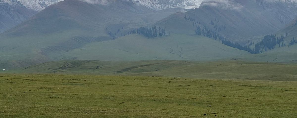
Nalati grassland with snow mountains
Hejing · 2,500m

Nalati grassland

Sunset on the Nine Bends — we wait for the sun to reach the right angle.
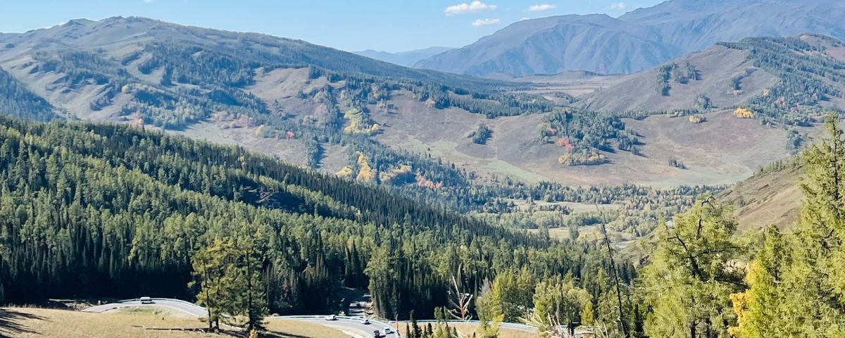
Duku Highway mountain road
Dushanzi–Kuqa · 3,400m

Duku Highway

Open only four months a year. We lock dates in the first week of the season.
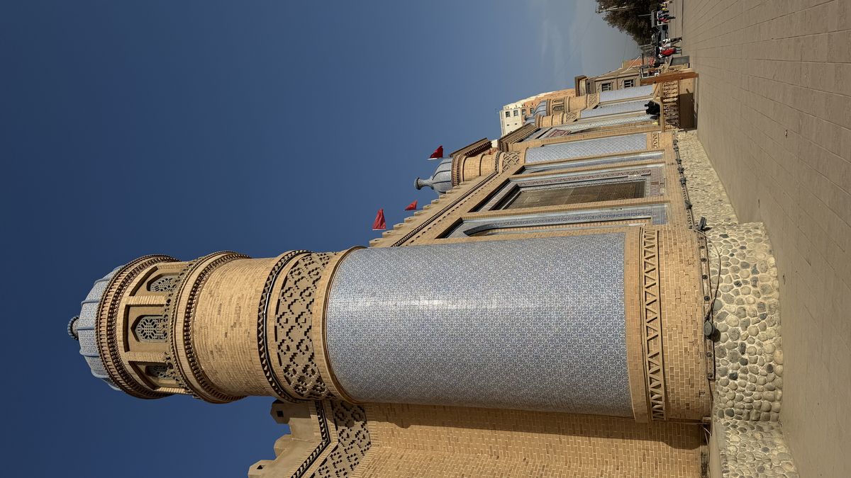
Kashgar old town
Kashgar · 1,290m

Kashgar old town

The lanes before 8am, when there are no other visitors — the best two hours of the day.
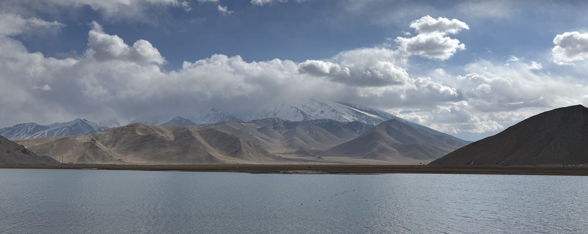
Muztagh Ata over a lake
Pamir · 4,700m

Muztagh Ata

We spend a night in a Kyrgyz herder's tent below the glacier park.

DAY BY DAY · 12-DAY NORTH & SOUTH XINJIANG

Every day kept under 400 km of driving

The 8-day and 14-day versions add or remove from this; you get a day-by-day PDF before departure.

D1

Arrive Ürümqi

Airport pickup. Xinjiang runs about two hours behind Beijing time — don't plan your day by the clock on your phone.

Ürümqi · 800m
D2

Ürümqi → Fuyun

North on Highway 216 along the edge of the Junggar Basin. A long day, split into two rest stops.

Fuyun · 800m · 480 km
D3

Fuyun → Hemu

Into Hemu in the afternoon, staying in a Tuva cabin. Sunset from the viewpoint.

Hemu · 1,400m · 380 km
D4

Hemu morning mist → Kanas

Mist at dawn, then into Kanas. The Three Bays walk is flat and easy.

Kanas · 1,374m · 70 km
D5

Kanas → Karamay

South across the Gobi, with the Yardang formations of Ghost City at sunset.

Karamay · 400m · 460 km
D6

Karamay → Sayram Lake

The loop around the lake is about 90 km. The colour of the water is unreasonable — we give it the whole afternoon.

Sayram Lake · 2,073m · 340 km
D7

Sayram Lake → Tekes

Over the Guozigou bridge to the Eight Trigrams town, with lavender fields on the way (June–July).

Tekes · 1,200m · 300 km
D8

Tekes → Bayanbulak

Onto the middle section of the Duku Highway, climbing to 2,500m, then sunset over the Nine Bends.

Bayanbulak · 2,500m · 260 km
D9

Bayanbulak → Kuqa

The southern Duku section, over the Tielimaiti pass. Grassland to red canyon in a single day.

Kuqa · 1,100m · 280 km
D10

Kuqa → Aksu → Kashgar

The longest driving day, with the two drivers rotating. Arrive at Kashgar's old town in the evening.

Kashgar · 1,290m · 540 km
D11

Kashgar · morning lanes and the bazaar

The lanes at 8am are empty of visitors — the best two hours. The livestock bazaar in the afternoon (Sundays are biggest).

Kashgar · 1,290m
D12

Kashgar → the Pamirs · departure

Up the Karakoram Highway to the Muztagh Ata glacier park; no more than an hour at 4,700m, then back down for your flight.

4,700m · 380 km
VEHICLES & HOTELS

Where the driving is long, both the vehicle and the driver have a backup

Vehicles & drivers

Two drivers rotating throughout; no one drives more than five hours a day. High-clearance vehicles, satellite phone and two spare tyres.

Hotel standard

Four-star standard in cities; cabins inside the Hemu and Kanas scenic areas. Bayanbulak is the simplest night — we flag it in advance and offer an alternative.

DISTANCE, PERMITS & RISK

The worst case first, in writing

Checkpoints and paperwork

Xinjiang has frequent security checkpoints; carry your passport at all times. Foreign passport holders are registered additionally at some points, and the Pamir section needs a border permit which we arrange — send your documents five working days ahead.

Duku Highway opening

Usually open mid-June to mid-October, and snow closes it without warning. If it closes we reroute via Highway 218 and refund the difference — you don't lose the trip.

Distance and endurance

About 5,000 km total, roughly six hours a day in the vehicle. If you suffer from motion sickness or back and neck problems, think hard about this route.

Pamir altitude

The Muztagh Ata stop sits at 4,700m and we keep it to under an hour. Travellers with a cardiovascular history should skip this section and wait in Kashgar.

PRICE & WHAT'S INCLUDED

Quoted for a group of two — the more travellers, the lower the per-person price

¥12,600 from / person · 8-day version · group of two · approx. US$1,750
Vehicle and two drivers for the full route (fuel, tolls included)
Licensed local guide throughout
Accommodation as listed, breakfast included
All entrance fees and park shuttle buses
Pamir border permit — arranged by us
Travel insurance with medical evacuation
Satellite phone and emergency communications
Accommodation inside the Hemu and Kanas scenic areas

Not included: flights to and from Ürümqi, main meals, personal expenses, single-room supplement. You get the itemised list before signing.

Enquire about this route
FAQ

The questions we get most

Is Xinjiang safe for foreign travellers?

Yes. Checkpoints are routine — show your passport and carry on. What genuinely needs planning is the distance and the clock: Xinjiang runs about two hours behind Beijing, and in summer the sun sets after nine in the evening.

Which month is best?

Mid-September to early October is the peak of northern Xinjiang's autumn, and also the most expensive and hardest two weeks to book. June–August is best for grassland but hot. The Duku Highway is only open June to October.

With this much driving, is it worth it?

It is, but not for everyone. In Xinjiang the scenery is on the road, not at the ticket gate. If six hours a day in a vehicle sounds like punishment, choose the shorter Sichuan or Tibet routes instead.

What paperwork do I need?

Your passport and Chinese visa for the main route; we arrange the Pamir border permit, so send documents five working days ahead. Expect checkpoints — keep your passport on you at all times.

Will my guide speak English?

Yes — an English-speaking guide leads every Xinjiang trip. In Kyrgyz and Uyghur villages your guide handles translation.

Tell us your travel month. We'll handle the rest.

Within 4 hours, an advisor who has walked this route contacts you

Plan this route